Geotate Upgrades Geotagging Service
 Geotate has upgraded its GPS Web-Service for adding location tags to digital images. “This upgrade of our Internet-based web-service coincides with the first Geotate technology-enabled products using our technology, being used by photographers. It represents another step in our ability to engineer innovative technology into market leading products,” said CTO Chris Marshall. Geotate’s software is used in JOBO’s photoGPS, amongst other products, and it allows you to record and discover the location where you took your pictures and videos.
Geotate Press Release
Geotate extends Web Service as products hit the market
Core component of Capture and Process system upgraded for users of first auto-geotagging products
Reigate, United Kingdom, 1 December 2008 - Geotate, the pioneering auto-geotagging company, announced that its GPS Web-Service for adding location tags to digital images has been upgraded. The innovative service is available to users of products that incorporate the company’s unique auto-geotagging technology.
Geotate’s Capture & Process software is establishing support from technology commentators and digital camera makers, as geotagging becomes an important part of the Digital Imaging Industry’s products and product roadmaps. “This upgrade of our Internet-based web-service coincides with the first Geotate technology-enabled products using our technology, being used by photographers. It represents another step in our ability to engineer innovative technology into market leading products,” said CTO Chris Marshall.
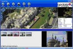
The geotagging service works with technology on a camera or dedicated device (such as JOBO’s photoGPS) to enable the user to record and discover the location where they took their pictures and videos. Firstly, it maintains an historical record of the GPS Satellite Ephemeris and Almanac data of all the satellites around the world, which using the company’s Capture & Process software uniquely enables photographers to augment each digital image with its geographic data. Secondly, the service delivers ‘reverse geocoding’, providing photographers with meaningful place names and points of interest alongside GPS based altitude, latitude and longitude.
The service has been running for development and GPS archiving purposes since January 2008, delivering an up time of better than 99.95%. It is now deployed on a fully redundant server and available to users.
Hans Streng, CEO of Geotate added: “Building a growing variety of geotagging services for the imaging industry and other tracking applications is a continuous focus of Geotate. We’re now working with leading partners for data supply and service provisioning to ensure we perform to the service levels consumer electronic giants and their customers expect.”
About Geotate
Geotate provides geotagging software to camera manufacturers and the digital imaging industry. Geotate’s unique technology can be embedded into cameras to instantly tag digital images with their location – auto geotagging, as it is known. Its auto geotagging technology is a cost effective, low power, easy to integrate into digital cameras and, critically, overcomes the limitations of traditional GPS solutions, for example, battery drain, time to fix, indoor location issues and cost. Geotate software enables users to easily get more from their digital image collection; improving visualisation, cataloguing and search.
Geotate is a recent spin-out from Philips with offices in Tokyo, Japan, Taipei, Taiwan, London, UK and Eindhoven, Netherlands.
Loading comments…